GDP: N/A


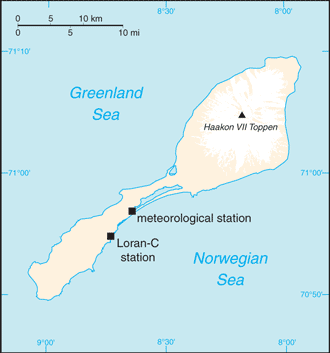
Population: Uninhabited except for staff at Long Range Navigation (Loran-C) base and the weather and coastal services radio station

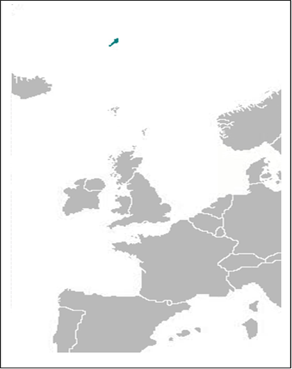
Area: 373 km2 or 144 mi2

Official Language: Norwegian

Political Information: Part of the Kingdom of Norway

Highest Mountain: Beerenberg Volcano at 2,277 m or 7,470ft


Map of Jan Mayen


Time Zone (UTC): +1:00


Wildlife:


Leaders: Territory of Norway; administered from Oslo through the county governor (fylkesmann) of Nordland.


Sources: CIA World Fact Book, and Encyclopaedia Britannica.

Flag of Jan Mayen
Technology and Inventions
njj
hgjjgyfftitiim
ti
Jan Mayen Map
Biology
Chemistry
Physics
Maths
History
Geography
General Knowledge
World Cultures
Music
Art
Film and Entertainment

Jan Mayen 

Earth Site Home
Map

Biology                  Chemistry                 Physics                  Maths                          History                    Geography              General Knowledge                  World Cultures                Music                  Art                Film and Entertainment                   Technology & Invention

Loading